

Loading
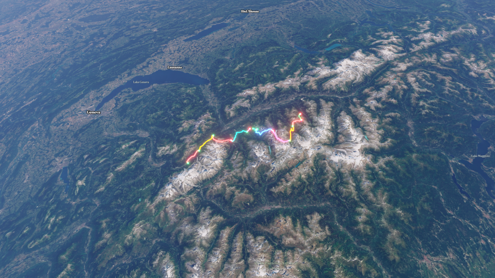
Haute Route
Hike
Haute Route
Jul 27, 2026 – Aug 3, 2026
The timeline
By the numbers
- Distance
- 117 km
- Ascent
- 6,982 m
- Descent
- 7,345 m
- Moving time
- 1d 11h 53m
Elevation profile
729 m → 2,973 m
Drag across the profile to follow the route on the map.
More stats
- Avg speed (moving)
- 3.3 km/h
- Avg speed
- 2.9 km/h
- Time
- 1d 16h 43m
Per leg
Haute Route Day 4 - Gondola to Verbier
- Distance
- 2.57 km
- Ascent
- 721 m
- Descent
- 22 m
- Moving
- 10m 36s
- Avg speed
- 14.5 km/h
Haute Route Day 8 - La Sage to Moiry
- Distance
- 10.1 km
- Ascent
- 1,152 m
- Descent
- 646 m
- Moving
- 3h 40m
- Avg speed
- 2.7 km/h
Haute Route Day 3 - Col de Forclaz to Lac Champex
- Distance
- 12.9 km
- Ascent
- 1,121 m
- Descent
- 1,172 m
- Moving
- 6h 38m
- Avg speed
- 1.9 km/h
Haute Route Day 8 - Bus from Arolla to La Sage
- Distance
- 14.3 km
- Ascent
- 280 m
- Descent
- 616 m
- Moving
- 41m 34s
- Avg speed
- 20.7 km/h
Haute Route Day 6 - Cabane Mont Fort to Cabane Prafleuri
- Distance
- 14.5 km
- Ascent
- 1,075 m
- Descent
- 872 m
- Moving
- 6h 37m
- Avg speed
- 2.2 km/h
Haute Route Day 5 - Verbier to Cabane de Mont Fort
- Distance
- 1.78 km
- Ascent
- 151 m
- Descent
- -
- Moving
- 34m 19s
- Avg speed
- 3.1 km/h
Haute Route Day 2 - Argentiere to Trient
- Distance
- 12.5 km
- Ascent
- 973 m
- Descent
- 895 m
- Moving
- 4h 29m
- Avg speed
- 2.8 km/h
Haute Route Day 5 - Lifts from Verbier to Le Chaud
- Distance
- 1.91 km
- Ascent
- 232 m
- Descent
- 164 m
- Moving
- 12m 26s
- Avg speed
- 9.2 km/h
Haute Route Day 1 - Chamonix to Argentiere
- Distance
- 9.61 km
- Ascent
- 410 m
- Descent
- 219 m
- Moving
- 2h 51m
- Avg speed
- 3.4 km/h
Haute Route Day 8 - Bus from Moiry to Grimentz
- Distance
- 7.22 km
- Ascent
- -
- Descent
- 653 m
- Moving
- 22m 08s
- Avg speed
- 19.6 km/h
Haute Route Day 7 - Cabane Prafleuri to Arolla
- Distance
- 15.5 km
- Ascent
- 720 m
- Descent
- 1,293 m
- Moving
- 5h 50m
- Avg speed
- 2.7 km/h
Haute Route Day 4 - Lac Champex to Verbier
- Distance
- 14.4 km
- Ascent
- 147 m
- Descent
- 795 m
- Moving
- 3h 44m
- Avg speed
- 3.8 km/h