

Loading
Mountaineering
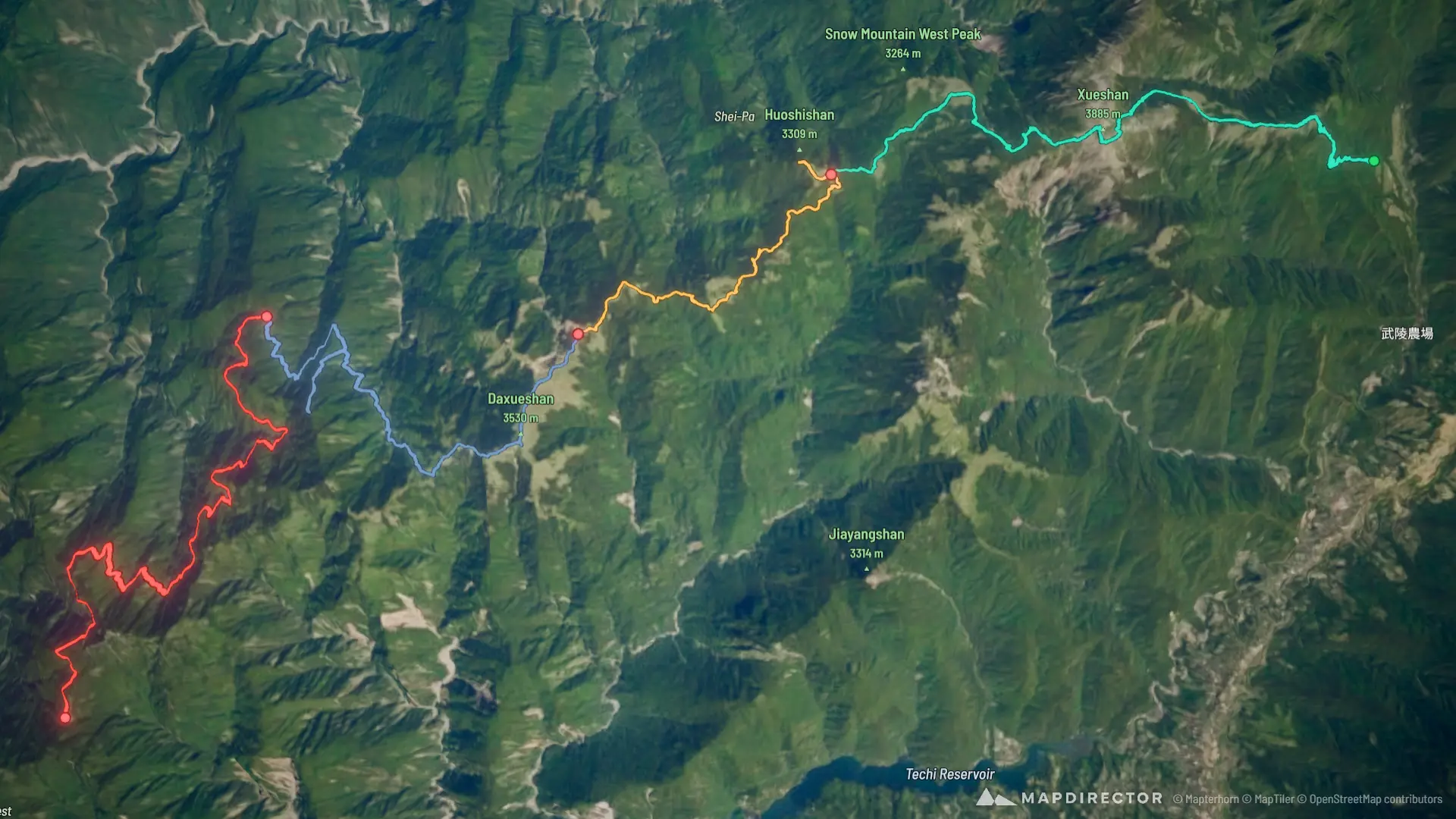
雪山西稜
Oct 9, 2026 – Oct 12, 2026

Mapped by
Mike Yeh
The timeline
By the numbers
- Distance
- 71.2 km
- Ascent
- 4,442 m
- Descent
- 4,014 m
- Moving time
- 1d 00h 32m
Elevation profile
2,156 m → 3,891 m
Drag across the profile to follow the route on the map.
More stats
- Avg speed (moving)
- 2.9 km/h
- Avg speed
- 2.1 km/h
- Time
- 1d 09h 29m
- Avg heart rate
- 118 bpm
- Max heart rate
- 157 bpm
- Avg temperature
- 24.7 °C
Per leg
和平區 登山
- Distance
- 19.4 km
- Ascent
- 1,951 m
- Descent
- 1,080 m
- Moving
- 7h 41m
- Avg speed
- 2.5 km/h
- Avg HR
- 124 bpm
- Max HR
- 157 bpm
- Avg temp
- 25.2 °C
泰安鄉 登山
- Distance
- 12.3 km
- Ascent
- 999 m
- Descent
- 738 m
- Moving
- 5h 20m
- Avg speed
- 2.3 km/h
- Avg HR
- 117 bpm
- Max HR
- 147 bpm
- Avg temp
- 25.8 °C
泰安鄉 登山
- Distance
- 18.5 km
- Ascent
- 1,171 m
- Descent
- 1,981 m
- Moving
- 6h 51m
- Avg speed
- 2.7 km/h
- Avg HR
- 117 bpm
- Max HR
- 147 bpm
- Avg temp
- 25.9 °C
泰安鄉 登山
- Distance
- 21.0 km
- Ascent
- 321 m
- Descent
- 214 m
- Moving
- 4h 39m
- Avg speed
- 4.5 km/h
- Avg HR
- 110 bpm
- Max HR
- 130 bpm
- Avg temp
- 19.9 °C