

Loading
Hike
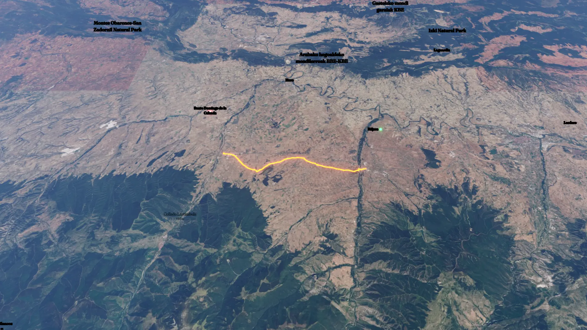
Nájera -> Santo Domingo de la Calzada
Jul 15, 2026
Mapped by
Max_ambro
The timeline
By the numbers
- Distance
- 22.8 km
- Ascent
- 358 m
- Descent
- 220 m
- Moving time
- 4h 11m
Elevation profile
493 m → 754 m
Drag across the profile to follow the route on the map.
More stats
- Avg speed (moving)
- 5.4 km/h
- Avg speed
- 4.4 km/h
- Time
- 5h 12m
- Avg heart rate
- 116 bpm
- Max heart rate
- 166 bpm
- Avg cadence
- 58 rpm