

Loading
Mountaineering
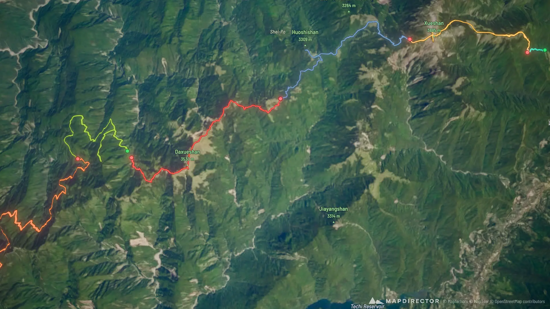
雪山西稜縱走
Sep 16, 2026 – Sep 21, 2026

Mapped by
旺旺
The timeline
By the numbers
- Distance
- 73.6 km
- Ascent
- 4,330 m
- Descent
- 3,993 m
- Moving time
- 1d 07h 45m
Elevation profile
2,285 m → 3,853 m
Drag across the profile to follow the route on the map.
More stats
- Avg speed (moving)
- 2.3 km/h
- Avg speed
- 1.3 km/h
- Time
- 2d 06h 44m
- Avg heart rate
- 121 bpm
- Max heart rate
- 172 bpm
Per leg
雪山西稜縱走 D1
- Distance
- 2.01 km
- Ascent
- 321 m
- Descent
- -
- Moving
- 58m 39s
- Avg speed
- 2.1 km/h
- Avg HR
- 134 bpm
- Max HR
- 163 bpm
雪山西稜縱走 D2
- Distance
- 11.1 km
- Ascent
- 1,413 m
- Descent
- 508 m
- Moving
- 6h 26m
- Avg speed
- 1.7 km/h
- Avg HR
- 122 bpm
- Max HR
- 171 bpm
雪山西稜縱走 D3
- Distance
- 13.8 km
- Ascent
- 551 m
- Descent
- 958 m
- Moving
- 5h 52m
- Avg speed
- 2.4 km/h
- Avg HR
- 127 bpm
- Max HR
- 172 bpm
雪山西稜縱走 D4
- Distance
- 13.6 km
- Ascent
- 956 m
- Descent
- 1,591 m
- Moving
- 7h 32m
- Avg speed
- 1.8 km/h
- Avg HR
- 127 bpm
- Max HR
- 168 bpm
雪山西稜縱走 D5
- Distance
- 15.5 km
- Ascent
- 804 m
- Descent
- 740 m
- Moving
- 6h 16m
- Avg speed
- 2.5 km/h
- Avg HR
- 114 bpm
- Max HR
- 151 bpm
雪山西稜縱走 D6
- Distance
- 17.6 km
- Ascent
- 285 m
- Descent
- 196 m
- Moving
- 4h 38m
- Avg speed
- 3.8 km/h
- Avg HR
- 102 bpm
- Max HR
- 134 bpm