

Loading
Multi-day Hike
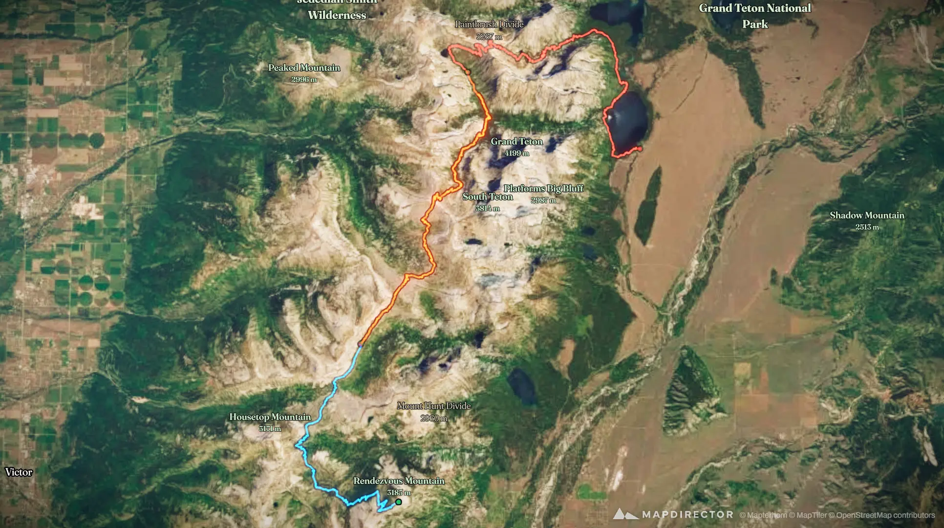
Teton Crest Trail
Aug 29, 2026 – Aug 31, 2026

Mapped by
John Christie
The timeline
By the numbers
- Distance
- 65.4 km
- Ascent
- 2,091 m
- Descent
- 3,184 m
- Moving time
- 17h 38m
Elevation profile
2,081 m → 3,280 m
Drag across the profile to follow the route on the map.
More stats
- Avg speed (moving)
- 3.7 km/h
- Avg speed
- 2.8 km/h
- Time
- 23h 32m
- Avg heart rate
- 119 bpm
- Max heart rate
- 164 bpm
- Avg cadence
- 56 rpm
- Avg temperature
- 25.9 °C
Per leg
Teton County Hiking
- Distance
- 17.6 km
- Ascent
- 583 m
- Descent
- 873 m
- Moving
- 5h 09m
- Avg speed
- 3.4 km/h
- Avg HR
- 112 bpm
- Max HR
- 163 bpm
- Avg cadence
- 54 rpm
- Avg temp
- 24.0 °C
Teton County Hiking
- Distance
- 23.2 km
- Ascent
- 779 m
- Descent
- 1,057 m
- Moving
- 6h 19m
- Avg speed
- 3.7 km/h
- Avg HR
- 117 bpm
- Max HR
- 163 bpm
- Avg cadence
- 56 rpm
- Avg temp
- 24.3 °C
Teton County Hiking
- Distance
- 24.6 km
- Ascent
- 729 m
- Descent
- 1,254 m
- Moving
- 6h 09m
- Avg speed
- 4.0 km/h
- Avg HR
- 129 bpm
- Max HR
- 164 bpm
- Avg cadence
- 58 rpm
- Avg temp
- 29.7 °C