

Loading
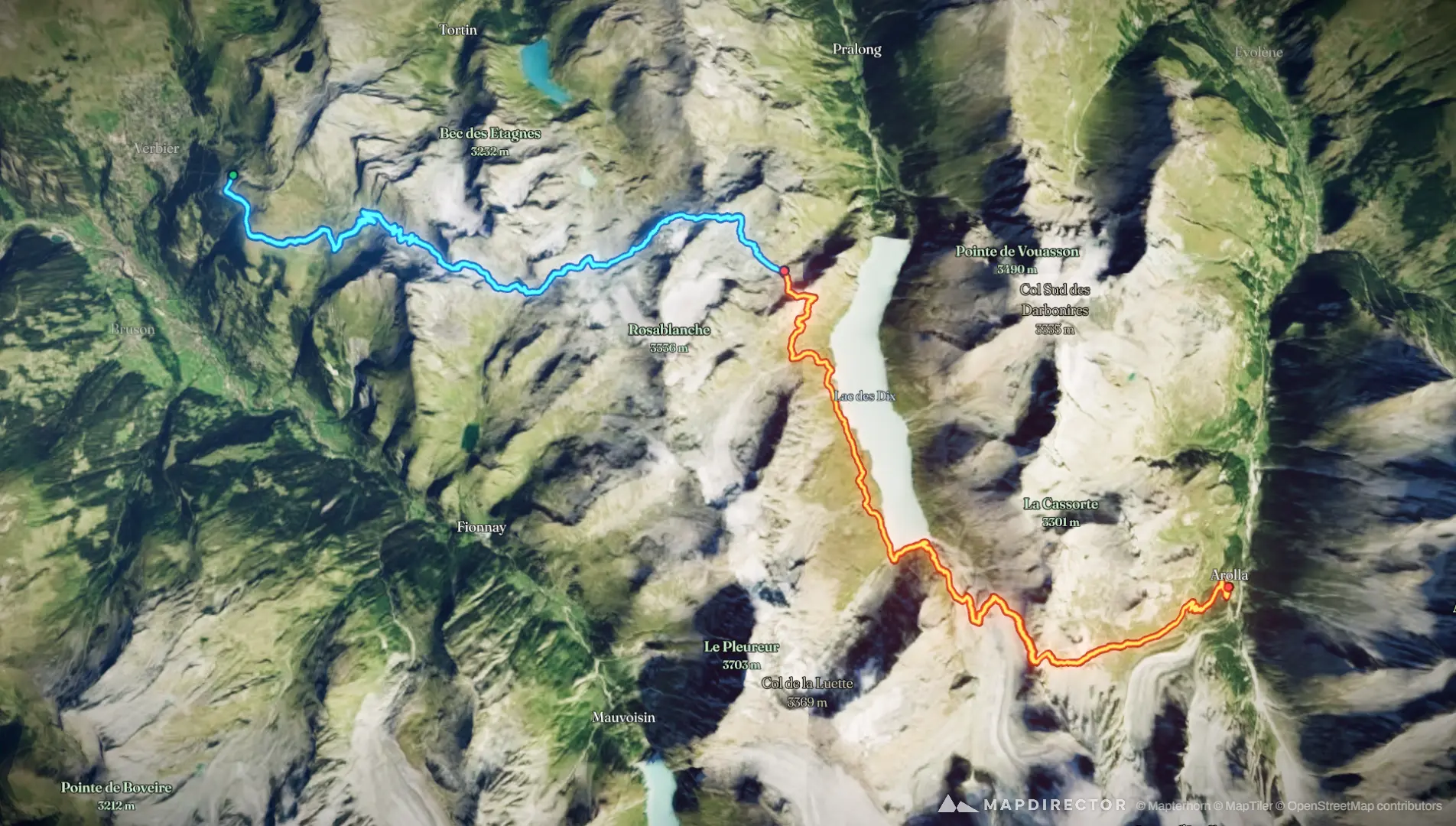
The Ronalds Route
Hike
The Ronalds Route
Aug 28, 2026 – Aug 29, 2026
The timeline
By the numbers
- Distance
- 33.8 km
- Ascent
- 2,003 m
- Descent
- 2,187 m
- Moving time
- 12h 07m
Elevation profile
2,017 m → 2,984 m
Drag across the profile to follow the route on the map.
More stats
- Avg speed (moving)
- 2.8 km/h
- Avg speed
- 2.3 km/h
- Time
- 14h 30m
- Avg heart rate
- 111 bpm
- Max heart rate
- 160 bpm
- Avg cadence
- 53 rpm
- Avg temperature
- 21.8 °C
Per leg
Bagnes Hiking
- Distance
- 15.8 km
- Ascent
- 1,316 m
- Descent
- 864 m
- Moving
- 6h 16m
- Avg speed
- 2.5 km/h
- Avg HR
- 106 bpm
- Max HR
- 143 bpm
- Avg cadence
- 51 rpm
- Avg temp
- 18.6 °C
Hérémence Hiking
- Distance
- 18.0 km
- Ascent
- 687 m
- Descent
- 1,323 m
- Moving
- 5h 50m
- Avg speed
- 3.1 km/h
- Avg HR
- 117 bpm
- Max HR
- 160 bpm
- Avg cadence
- 54 rpm
- Avg temp
- 25.4 °C